REVIEW · AUCKLAND
Auckland: 36 min scenic helicopter flight – Coast to Coast
Book on GetYourGuide →Operated by INFLITE Mt Cook Ski Planes & Helicopters · Bookable on GetYourGuide
Auckland looks different from up here. You’ll love how this flight strings together Waitakere Ranges views and the black-sand Bethells Beach coastline, then keeps going so you still get the city from above. Pilot commentary helps you keep your bearings, even when the view changes fast.
The main thing to consider is that helicopters are weather dependent, and there are weight limits. If you’re traveling on a tight schedule, you’ll want some flexibility for rescheduling if skies don’t cooperate.
In This Review
- Key Things That Make This Auckland Helicopter Flight Special
- Why This Auckland Helicopter Route Works So Well in One Flight
- From Albany to Bethells Beach: Black Sand and Volcanic Cliffs
- Waitakere Ranges and Manukau Harbour: Green Hills and Hidden Water
- Back Over Auckland: Sky Tower, Viaduct Harbour, and Harbour Bridge Views
- Devonport Naval Base, North Head, and the Rangitoto Crater
- Aircraft Types, Weight Limits, and What That Means for Comfort
- Timing, Weather Dependence, and How to Pick Your Best Day
- Safety, Pilot Commentary, and the Small-Group Advantage
- Price Check: Is $358 Worth It for 30 Minutes in the Air?
- Should You Book This Auckland Helicopter Flight?
- FAQ
- How long is the helicopter flight?
- What places will we see during the flight?
- Is this tour weather dependent?
- How many people are in the group?
- Is there a minimum number of passengers to confirm the booking?
- Are there weight limits?
- What language is the commentary in?
- Can I cancel and get a refund?
Key Things That Make This Auckland Helicopter Flight Special
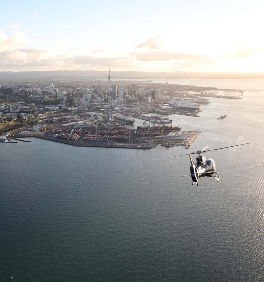
- West Coast, City, and Volcanic Island in one loop so you don’t lose time driving
- Bethells (Te Henga) black-sand beaches and volcanic cliffs with surf and jagged rock views
- Waitakere Ranges pass-over plus a look at water reservoirs tucked into the hills
- Auckland’s iconic skyline landmarks including Sky Tower and Viaduct Harbour
- Rangitoto Island crater views plus North Head and Devonport Naval Base from above
- Small group size (up to 7) which makes the experience feel more personal than mass tours
Why This Auckland Helicopter Route Works So Well in One Flight
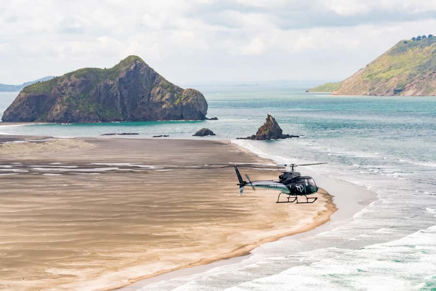
Auckland is one of those cities where the best views aren’t just in the downtown core. The coastline is dramatic. The volcanic bits are close by. And the green hills of the Waitakere Ranges are right there when you want something wilder than a city skyline.
That’s why this tour feels efficient. In about a half hour in the air, you’re set up to see a big geographic range: coastlines on the West, then water and harbors around the city, and finally volcanic terrain at Rangitoto. It’s a great choice if you want a wow-factor day without burning hours in a car.
You’ll also benefit from the fact that the pilot provides detailed commentary. From the air, it’s easy to think everything looks like similar coast and similar hills. The commentary helps you understand what you’re actually seeing—why that coastline looks like that, why those volcanic shapes matter, and how the city fits into the geography.
From Albany to Bethells Beach: Black Sand and Volcanic Cliffs
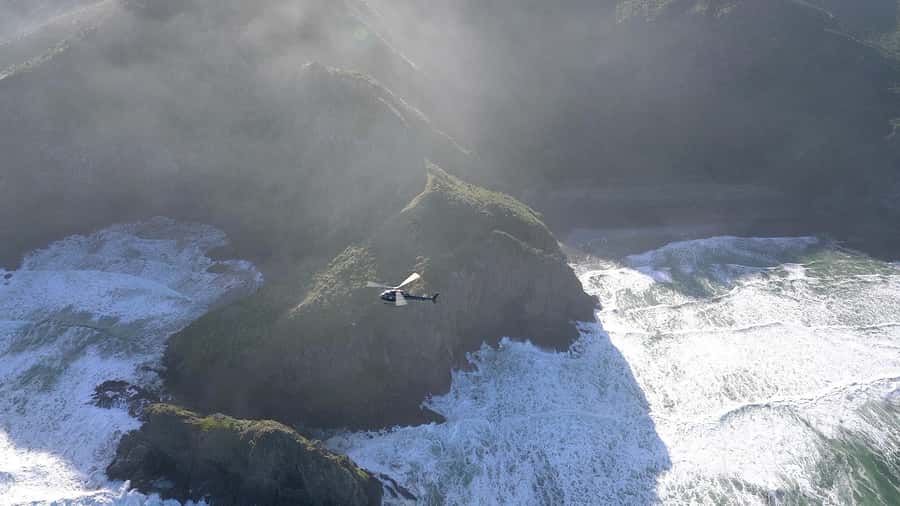
The flight starts by lifting you over the Albany area and then tracking across places like Kumeu and Huapai before turning toward Bethells (Te Henga) Beach. This is where the tone of the trip changes from urban to rugged.
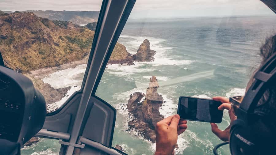
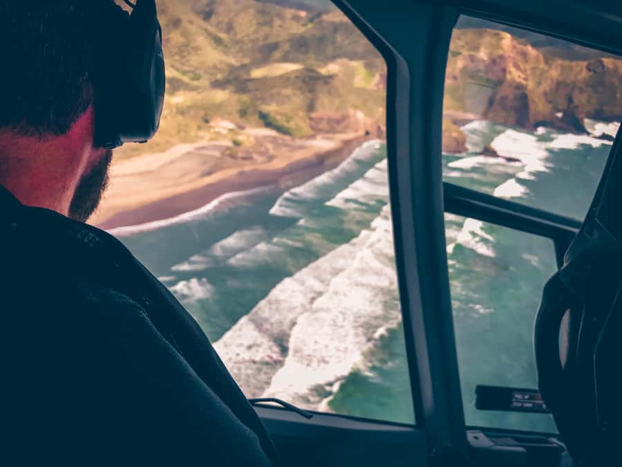
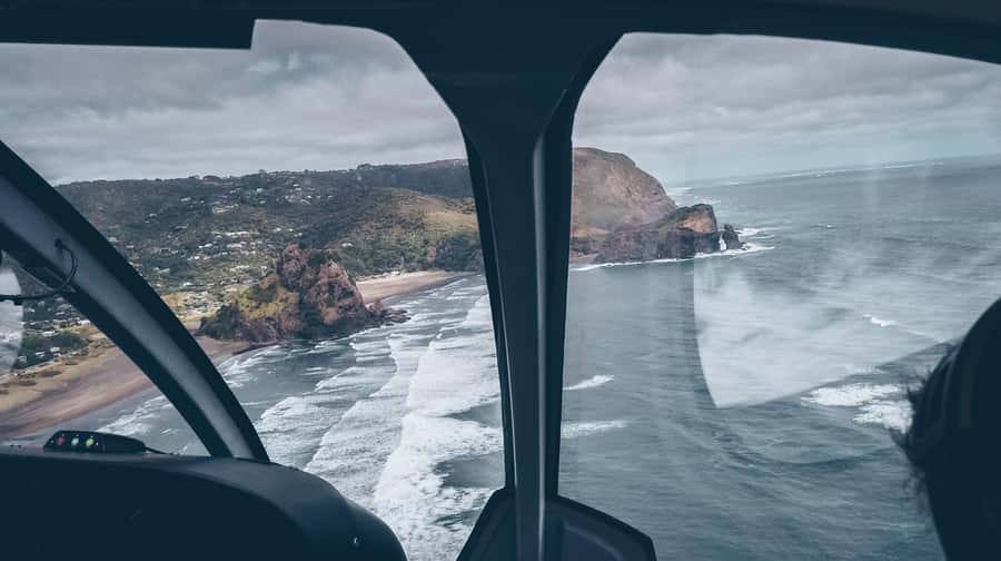
As you approach Bethells, you’re in the zone of surf-pounded black-sand beaches and volcanic cliffs. From ground level, beaches can look like a strip of sand. From above, you see the shape of the coastline: where the water hits, where the cliffs break, and where jagged rocks and caves cut into the shoreline.
Two practical reasons this part is so satisfying:
- You get “this can’t be faked by a photo” angles, because the coastline curves in ways you just don’t notice from the road.
- You see the contrast between darker sand, volcanic rock, and the surrounding bush cover in one continuous sweep.
One tip: if you want photos, think about how you’ll frame the coastline rather than just grabbing a wide shot. The cliffs and cave-like rock features can look like abstract shapes until you line them up against the shoreline.
Waitakere Ranges and Manukau Harbour: Green Hills and Hidden Water
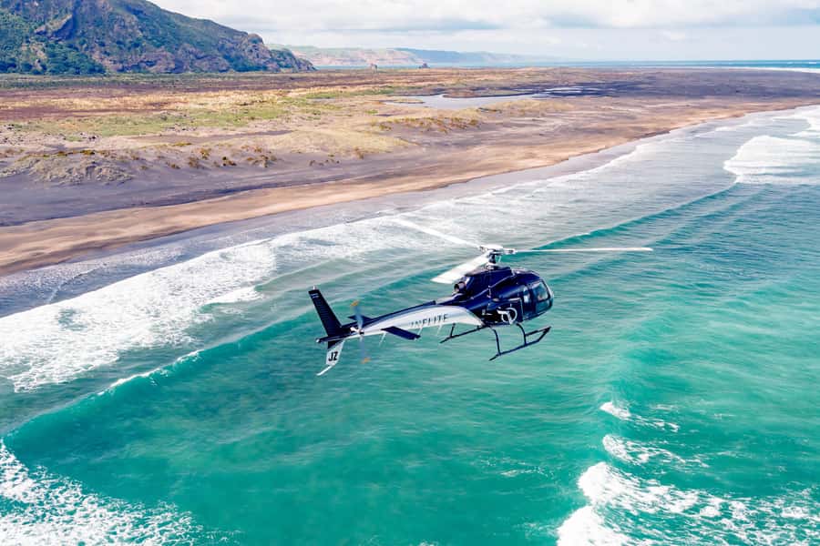
After the West Coast coastal views, the helicopter heads over the Waitakere Ranges. This is a big deal for Auckland sightseeing because it’s a reminder that the city isn’t isolated from wild terrain.
From the air, the ranges look like a layered quilt—hills, forest cover, and then those patchwork shapes of waterways and infrastructure. The tour specifically includes passing over water reservoirs hidden within the ranges. That’s the kind of detail you usually never spot on a typical sightseeing day.
Then, you go almost to the mouth of the Manukau Harbour, where the scenery shifts again. The feeling changes from rugged coastal power to a more enclosed, harbor-like system of land and water.
What I like about this segment is the pacing. It doesn’t just bounce you from one landmark to the next. You get a stretch of scenery where the pilot can connect the geography: how the land forms the coastline, how the ranges feed the water systems, and how harbors shape what you see from above.
Back Over Auckland: Sky Tower, Viaduct Harbour, and Harbour Bridge Views
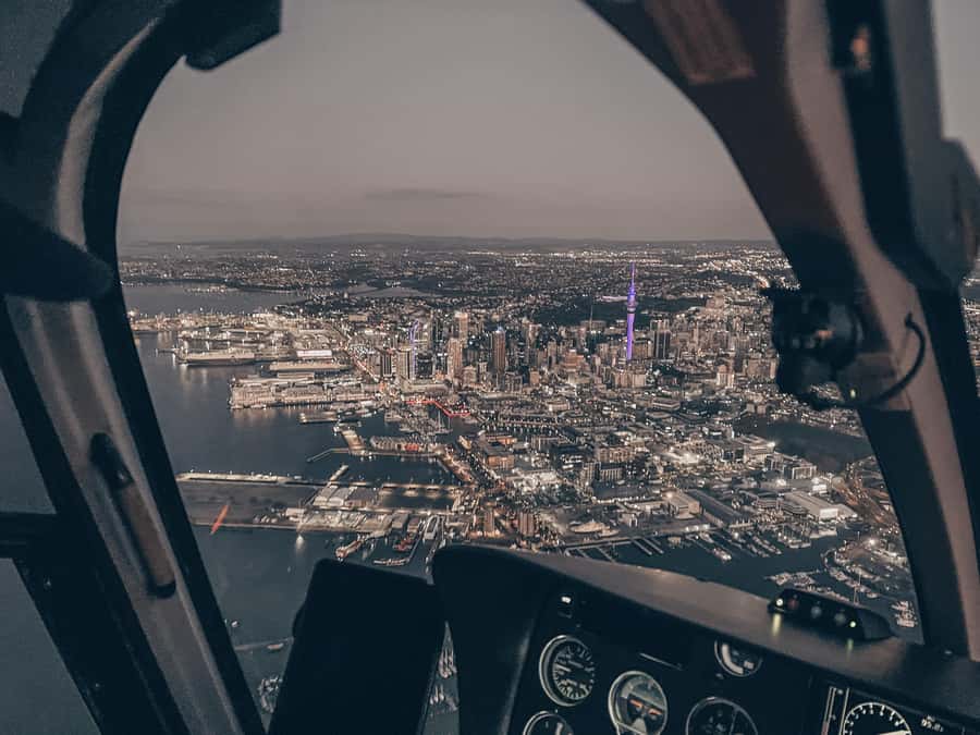
Once you swing back toward the city’s central area, you’ll get the “Auckland as a city” perspective. This is where the skyline landmarks make sense because you can see how they sit relative to the water.
You’ll fly over Downtown Auckland, Viaduct Harbour, and past Sky Tower and the Harbour Bridge. From the air, these aren’t just named monuments. You see their spatial relationships: which side of the water they sit on, how the harbor bends, and how the city spreads around it.
This part works especially well if you’ve only seen Auckland from viewpoints, ferry rides, or street-level walks. Street views are focused. The helicopter view is not. It’s a fast but clear way to get your bearings fast.
Also, if you’re the kind of person who likes structure, this city segment gives it to you. The water outlines the city; the skyline marks where you are; and the route helps you understand Auckland as a coastal system, not just a set of streets.
Devonport Naval Base, North Head, and the Rangitoto Crater
On the way toward the end of the flight, the helicopter tracks across Waitemata Harbour to the Devonport Naval Base and North Head. This is one of the more unique contrasts on the route: you’re looking at military-linked coastal territory while still having city water views in the background.
Then comes a true highlight for many people: Rangitoto Island, including the crater. Seeing a volcanic crater from above is one of those views that changes how you understand a place. The crater is not just a fact on a map—it’s a visible shape in the landscape, with the surrounding water and island geometry giving it scale.
Why this segment lands for value:
- It’s one of Auckland’s most distinctive natural features.
- It’s far enough from downtown that a quick day trip usually takes time, but from the air it becomes part of the same loop.
- You get the “big landmark” feeling without having to pick between city and nature.
If you’re planning this around a special moment, this is also a strong time window. People use helicopter rides for milestones, anniversaries, and even proposals in the sky—mostly because the view is so dramatic and concentrated.
Aircraft Types, Weight Limits, and What That Means for Comfort
You don’t always get the same aircraft on every booking, and the tour data is clear about that. The plane you fly in depends on group size and availability.
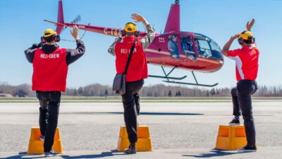
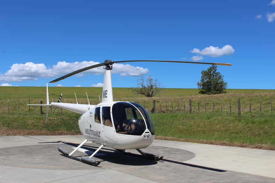
Smaller groups (like 2–3 people) may fly in a Robinson R444-7. For 4–7 people, you may fly in a jet turbine helicopter model such as AS350/355 Squirrel, Airbus EC130, Bell 427, or AW109s.
Why you should care: bigger or different models can feel different in the air, especially in terms of ride smoothness and cabin layout. The tour provider says aircraft are subject to availability, so the best approach is to be ready for what’s scheduled—not what you imagined.
Two booking realities you should plan around:
- Weight limitations apply on all flights (not suitable for people over 264 lbs / 120 kg).
- Weight considerations matter more than you think, because helicopter capacity is strict.
What to wear: the data doesn’t list specific clothing, so I’ll keep this practical. Wear comfortable layers you can handle with wind and cool air around aircraft. And keep your items simple. Oversize luggage isn’t allowed, and the vibe is very much about personal carry rather than bringing a bunch of extras.
Timing, Weather Dependence, and How to Pick Your Best Day
This flight is heavily weather dependent. That’s not just fine print—it’s the difference between a great scenic flight and a postponed one.
Scenic flights generally run in the morning or afternoon, and that matters because weather patterns often shift through the day. If you can choose, you may want to pick a time window that gives you options on the same day if schedules change.
The flight length is listed as 30 minutes in the activity details, while the experience is described as a 36-minute scenic flight. The takeaway for planning is that you’re looking at a short aerial experience. You won’t have time to be indecisive while you’re there. Decide in advance what you want most: West Coast ruggedness, city landmarks, or Rangitoto crater.
One more timing note: date and times are confirmed based on availability, and booking availability is confirmed within 24 hours. That’s why it helps to have Auckland days that aren’t packed shoulder-to-shoulder with other timed plans.
Safety, Pilot Commentary, and the Small-Group Advantage
Helicopter tours are an instant bucket list item for a reason. But the best ones also feel controlled, professional, and clear—especially when you’re flying close to coastline and around dense city zones.
This experience is run as a small group with a maximum of 7 participants. For you, that usually means less waiting, more room to hear the pilot, and less crowd noise competing with the commentary.
Also, the tour includes detailed commentary from your expert pilot. When you’re seeing everything quickly—coastline curves, ranges, harbors, and then a volcanic crater—it helps to have someone explaining what you’re looking at right now.
From the perspective of what people report about the ride, there’s a strong theme of professionalism and a feeling of safety during the flight. That makes sense with a route that’s structured and guided from takeoff to return.
One practical note on behavior: the tour rules are strict about things like smoking, vaping, intoxication, drones, and alcohol. Follow those and you’ll help keep the experience smooth for everyone.
Price Check: Is $358 Worth It for 30 Minutes in the Air?
At $358 per person, this isn’t a budget activity. It’s a splurge. But it’s also a very focused splurge, which changes the value calculation.
Here’s how I’d think about it:
- You’re paying for a route that covers West Coast rugged coastline, black-sand beaches, Waitakere Ranges, multiple Auckland harbor landmarks, and Rangitoto crater in one flight.
- If you tried to replicate that with car + viewpoints + separate day trips, you’d spend a lot more time coordinating and traveling.
- You’re also paying for the helicopter format: you get the birds-eye context and the skyline-to-coast connections that you just can’t get from a single ground lookout.
So the question isn’t whether the price is high. It’s whether you want to spend your Auckland time on scenic flight time instead of logistics time.
This is also a strong option if you’re celebrating something. A short flight that feels cinematic tends to deliver that milestone feeling more easily than a long day of standard sightseeing.
Should You Book This Auckland Helicopter Flight?
Book it if you want a high-impact aerial overview of Auckland that doesn’t require a full day of driving. It’s especially good for first-timers who want both coast and city, and for anyone who thinks the best photos come from perspective you can’t easily create on foot.
Pass or postpone if you’re traveling with zero flexibility for weather. This one is weather dependent, so a fixed tight schedule can make it stressful. Also, if you’re above the stated weight limit, it won’t be suitable.
If you’re within the weight range and you can give yourself a weather window, I’d treat this as one of those “pay for time and viewpoint” experiences. You’re not just seeing Auckland—you’re seeing how Auckland is built from coastline, ranges, harbors, and volcanoes.
FAQ
How long is the helicopter flight?
The experience is listed with a duration of 30 minutes. The scenic flight is described as 36 minutes, so you’ll want to confirm the exact time shown for your departure.
What places will we see during the flight?
You’ll fly over Auckland’s West Coast and rugged coastline, including Bethells (Te Henga) Beach, the Waitakere Ranges, and areas near the Manukau Harbour. You’ll also see Downtown Auckland, Viaduct Harbour, Sky Tower, Harbour Bridge, Waitemata Harbour, Devonport Naval Base, North Head, and Rangitoto Island crater.
Is this tour weather dependent?
Yes. Flights are heavily weather dependant, and your date and time are subject to availability.
How many people are in the group?
It’s a small group limited to 7 participants.
Is there a minimum number of passengers to confirm the booking?
Yes. A minimum of 2 passengers is required to confirm a booking.
Are there weight limits?
Yes. The experience is not suitable for people over 264 lbs (120 kg). Weight limitations apply to all flights.
What language is the commentary in?
The pilot provides detailed commentary in English.
Can I cancel and get a refund?
Yes. You can cancel up to 24 hours in advance for a full refund.