REVIEW · CHRISTCHURCH
Christchurch Scenic Helicopter Tour
Book on Viator →Operated by Garden City Helicopters · Bookable on Viator
Seeing Christchurch from above changes everything.
This 20-minute Garden City Helicopters flight is a fast way to grasp scale and rebuilding after the 2010 and 2011 earthquakes, with live pilot commentary guiding you over the city and out toward Banks Peninsula. I especially like the tight group size (max 4) and the fact that the pilot points out what you’re actually looking at—from ChristChurch Cathedral to the Ōtākaro Avon River Corridor. One drawback to plan for: it’s weather dependent, and flight plans can shift if conditions don’t cooperate.
You’ll also get a true “wow” factor that you just can’t get from ground viewpoints—city blocks, road layouts, and coastline details read instantly when you’re up there. If you’re the type who hates waiting around for weather updates, you’ll want to build in some buffer time on your schedule.
In This Review
- Key things to know before you fly
- A 20-minute helicopter hop over earthquake Christchurch and Banks Peninsula
- Price and what makes it feel worth it
- Timing: start times, weather delays, and late-afternoon magic
- Where you meet: Harewood and the Christchurch International Airport helibase
- Onboard experience: tiny group size and live pilot storytelling
- Over Cathedral Square: seeing the 2011 damage and the new Transitional Cathedral
- The Red Zone and the Ōtākaro Avon River Corridor from above
- Stadia, suburbs, and the scale of rebuilding across the city
- Lyttelton Harbour (Whakaraupō): the volcano-shaped inlet and the working port
- Quail Island and the Port Hills: island views and military-era coastlines
- Sumner Beach and New Brighton Pier: coast views you can’t fake
- What could disappoint you (and how to avoid it)
- Who this fits best
- Should you book the Christchurch Scenic Helicopter Tour?
- FAQ
- How long is the helicopter flight?
- Where does the tour depart from?
- How many passengers are on each flight?
- Do I get live commentary during the flight?
- Is the tour canceled if weather is bad?
- What’s the weight limit?
- Do I need to reconfirm before I go?
- What if I need to cancel?
Key things to know before you fly
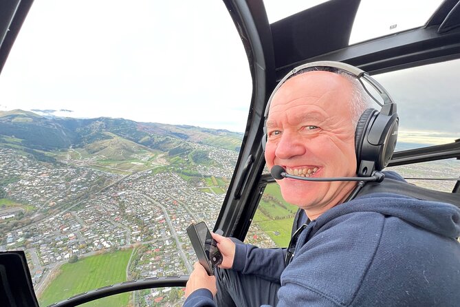
- Max 4 passengers means less crowding and more room to see out clearly
- Live pilot commentary helps you connect landmarks to the story of rebuilding
- Short flight, big coverage: city center, the red zone, Lyttelton Harbour, and the Port Hills
- Photographer-friendly: aerial angles over Cathedral Square, the harbour, and bays
- Weather dependent and you’ll need to reconfirm 24 hours before departure
A 20-minute helicopter hop over earthquake Christchurch and Banks Peninsula
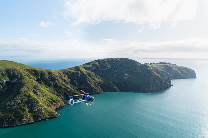
Christchurch is a city of layered change. Up close, you notice construction fences and fresh signage. From the air, you understand the whole pattern—what was lost, what’s been rebuilt, and what’s still “under negotiation” as the city evolves.
This tour is only about 20 minutes in the air, but it’s packed with the kind of aerial perspective that makes everything click. You’ll fly over the city center, then swing toward Lyttelton Harbour (Whakaraupō) and out along the Banks Peninsula coastline. The pilot talks through what you’re seeing as you go, so you’re not just collecting photos—you’re learning how the city is shaped and reshaped.
For first-time helicopter riders, it also has a nice “confidence boost.” The operation is professional and the aircraft load is small, so you’re not stuck shoulder-to-shoulder with strangers like you might be on larger sightseeing flights. And if you’re celebrating something, that front-desk care matters too—one passenger noted how the team made a birthday flight feel extra special, including a screen-tracking follow-along from the ground.
The big planning consideration: you don’t control the weather. If conditions are poor, you may need to switch your timing or date.
You can also read our reviews of more tours and experiences in Christchurch.

Price and what makes it feel worth it
At $217.20 per person, this isn’t a cheap impulse buy. The value comes from three things working together:
- You’re paying for access to a bird’s-eye view of a big, spread-out city and coastline in one go.
- Live commentary gives context, not just sightseeing passes.
- Small-group flight (up to 4 passengers) gives better viewing and a calmer onboard feel than bigger operations.
You could argue a helicopter tour is pricey compared with a gondola, walking loop, or a standard city bus route. But the whole point here is the aerial “pattern recognition” you get over Christchurch’s recovery areas and the peninsula’s volcanic coastline. If you want to see both in a single short window, the pricing starts to make more sense.
If you’re hoping for a long, panoramic flight with no turns—this is not that. It’s short by design, and the pilot’s route can be adapted by conditions.
Timing: start times, weather delays, and late-afternoon magic
The tour offers multiple start times, which matters because Christchurch light changes fast across the day. One strong clue from onboard experience: people loved late-afternoon views, when the city edges and coastline feel crisp and the angles look less harsh.
Still, be realistic. This is a weather-dependent activity. Plan for the possibility of switching slots if weather changes, and don’t book it as the only thing you can do that day. A good strategy is to pair it with flexible activities near Christchurch, so you’re not trapped.
Also, you’ll need to reconfirm your booking 24 hours prior to departure to check weather conditions. That’s not busywork—it’s how you avoid turning up to a canceled flight.
Where you meet: Harewood and the Christchurch International Airport helibase
The meeting point is listed at 73 Grays Road, Harewood, Christchurch 8042. From there, your operation departs from the helibase at Christchurch International Airport.
Practically, this means you should plan for a short transfer time between where you check in and where you board. The good news: the meeting point is near public transportation, which helps if you’re not driving.
If you’re choosing rideshare or taxi, give yourself extra time. Helicopter check-in runs on schedules, and you don’t want to be sprinting in with your bag still zipped.
Onboard experience: tiny group size and live pilot storytelling
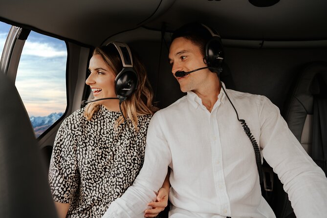
This flight tops out at 4 travelers, so you should expect a quieter cabin and clearer sightlines. The pilot also controls seating based on weight and balance requirements, so don’t be surprised if your seat assignment isn’t exactly where you’d pick in a car.
That weight detail matters. You’ll be weighed on check-in, and the total weight per passenger listed is 221 lbs (about 100 kg). If you’re near that limit, double-check your own fit with the stated requirement before you book.
What you’ll remember most is the human part: the pilot commentary. Different pilots bring different styles, and the names you might hear include Chris and Jake, both described as friendly and informative in their roles as tour guides from the cockpit area.
There’s also a nice touch from staff care. One featured account highlighted a front-of-house team member who helped make the flight memorable by allowing a child celebrating a birthday to follow the route on a tracking screen while in the air. That’s the kind of detail that turns a sightseeing flight into a story you’ll talk about later.
Over Cathedral Square: seeing the 2011 damage and the new Transitional Cathedral
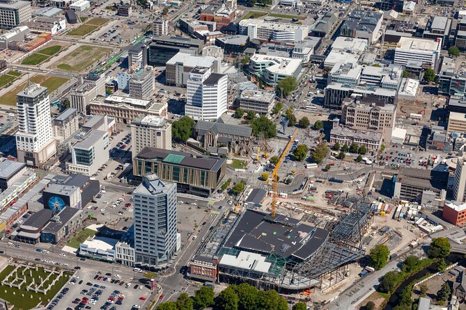
Christchurch’s earthquake recovery is visible from the sky in a way that’s hard to capture on the ground. The pilot points out ChristChurch Cathedral, which was badly damaged in the 2011 earthquake. The view from above helps you understand why Cathedral Square matters—it’s not just a building, it’s a focal point that anchors the city’s identity.
Nearby, you’ll also see the Transitional Cathedral, which has taken the place of the old structure. From the air, it’s easier to grasp how the surroundings are being reworked while the city plans long-term restoration.
If you’re the kind of visitor who likes context—this is where the live commentary earns its keep. It’s one thing to read signs. It’s another to look down and hear why those repairs or changes are happening where they are.
The Red Zone and the Ōtākaro Avon River Corridor from above
One of the most meaningful aerial moments is the view over the red zone, an area that was once filled with homes and later became part of a different plan for how land and people connect.
The pilot’s explanation includes the Ōtākaro Avon River Corridor project—a shift in what the area is for. Up in the helicopter, you can actually see the logic of the transformation: corridors, open space, and how the city’s edges are being reconnected rather than simply rebuilt block-by-block.
If you’re coming to Christchurch for the “recovery story,” this is the heart of it. You get the “before and after” feeling without needing long research time.
Stadia, suburbs, and the scale of rebuilding across the city

You’ll also fly over the new sports stadium, and the pilot shares the city’s vision for what’s next. Again, you can take photos from street level. But from the air, you can quickly judge how central that stadium is and how the surrounding neighborhoods connect.
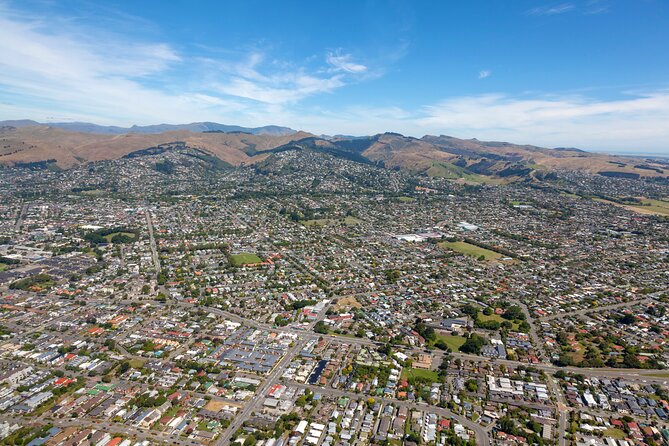
The route continues over suburban areas too, including Sumner and Redcliffe. Seeing these communities from above is a reminder that the earthquake impact wasn’t isolated to a single zone. It shaped the coastline, the commuting patterns, and the way development continued.
This is also where some people set their expectations. Since the flight is only about 20 minutes, the route covers a broad sweep rather than lingering over one neighborhood for a long time.
Lyttelton Harbour (Whakaraupō): the volcano-shaped inlet and the working port
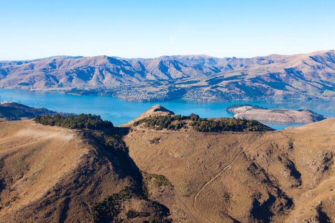
Banks Peninsula isn’t just pretty coastline. It’s a volcanic story. When you fly toward Lyttelton Harbour (Whakaraupō), the pilot explains that the harbour is formed by an ancient volcano and flooded by the sea.
From above, you’ll see why it’s such a big deal: the harbour is a major port for Christchurch. You can spot the shape of the inlets and the way the water meets the land, giving you a clearer sense of the region’s geography than most driving routes do.
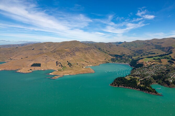
Then the tour continues toward the peninsula’s coastal pockets. You might even catch views of Diamond Harbour, described as a beautiful stretch of coastline, plus details around smaller islands.
Quail Island and the Port Hills: island views and military-era coastlines
Two of the most “Canterbury-specific” sights show up as you range along the peninsula.
First, you’ll likely get a view of Quail Island, listed as Canterbury’s largest island in Diamond Harbour. It’s the kind of landmark that’s easy to miss when you’re only moving along roads.
Second, you’ll see the Port Hills—a range between Christchurch and the port at Lyttelton. The pilot notes they’re named because of their position and that they’re an eroded remnant of the Lyttelton volcano. That volcanic origin ties the whole trip together: you’re seeing the same story in different forms—harbour shape, ridgelines, and bays.
And then there’s the military coastline: Awaroa/Godley Head, where World War Two defense sites sit along the shore. From the air, those placements make sense in a way they don’t always on foot—you can see the defensive logic of what’s facing the sea.
Sumner Beach and New Brighton Pier: coast views you can’t fake
As you return, you’ll fly over the coastline again, including Sumner Beach. It’s described as a seaside suburb popular for surfing, swimming, and sea fishing. From the helicopter, the beach layout and water colors read instantly, and you get a better sense of where the crowds would cluster versus where it looks calmer.
You’ll also see New Brighton on Pegasus Bay, including the New Brighton pier, listed as the longest in Australasia. When you’re above it, a pier becomes more than a photo subject—it becomes a landmark for how the coastline is built out and where the shoreline curves.
What could disappoint you (and how to avoid it)
A short helicopter tour can’t be everything for everyone. One person was disappointed by the amount of variety and felt it was closer to a quick circuit than a full “see-everything” experience.
Here’s how to avoid that outcome for yourself:
- Go in expecting a broad overview, not a long linger.
- Treat it as a perspective shift: earthquake recovery + coastline + harbours.
- Keep your schedule flexible in case weather adjustments are needed.
If you want a helicopter ride mainly for speed and views, this likely hits the mark. If you want an extended, slow-motion narration of every neighborhood, you may feel it’s too short.
Who this fits best
I’d point you toward this tour if you’re:
- A photographer who wants quick aerial angles over specific landmarks like Cathedral Square and the harbour
- Visiting Christchurch for the recovery story and you want the scale at a glance
- Taking a first helicopter ride and want a friendly, small-group experience
- Short on time but still want city + peninsula in one outing
It’s less of a match if you dislike weather uncertainty, or if you’re only interested in one single neighborhood and would rather spend time there on foot or by car.
Should you book the Christchurch Scenic Helicopter Tour?
If you can handle the weather factor and you’re excited by aerial views, I think you’ll enjoy this a lot. The combination of small group size, live pilot commentary, and the city’s recovery story makes it feel more meaningful than generic sightseeing flights.
For best results, book a start time that leaves room for delays, and aim for lighting that makes the coastline crisp. If you’re arriving ready to learn what you’re seeing—especially over Cathedral Square, the red zone, and Lyttelton Harbour—this tour gives you a fast, memorable way to understand Christchurch in motion.
FAQ
How long is the helicopter flight?
The tour is about 20 minutes (approx.), with flight time listed as 20 minutes.
Where does the tour depart from?
The tour includes a departure from the helibase at Christchurch International Airport, with the meeting point listed at 73 Grays Road, Harewood.
How many passengers are on each flight?
The helicopter tour is limited to a maximum of 4 travelers.
Do I get live commentary during the flight?
Yes. The experience includes live commentary from your pilot while you fly.
Is the tour canceled if weather is bad?
Yes, it’s weather dependent. If it’s canceled due to poor weather, you’ll be offered a different date or a full refund.
What’s the weight limit?
Passengers are weighed at check-in, and the listed total weight per passenger is 221 lbs (about 100 kg). Weight and balance rules also determine seating.
Do I need to reconfirm before I go?
You must reconfirm your booking 24 hours prior to departure to check weather conditions.
What if I need to cancel?
Cancellation is free up to 24 hours in advance for a full refund. If you cancel less than 24 hours before the start time, it’s not refunded.